Southern Arizona makes a great jumping off point for outdoor adventure to enjoy varied activities within close proximity. I spent a week in Southern Arizona in February 2026 with my husband and 2 year old son. The adults fulfilled their wish for a desert hiking trip and the toddler got to visit the zoo, playgrounds, and walk among planes at the Air and Space Museum. It was a win-win for everyone!
Tucson Makes a Great Home Base
While Tucson does have an airport, Tucson International Airport (TUS), our family flew into Phoenix Sky Harbor International Airport (PHX) because we were able to find a direct flight from our home airport to Phoenix, but not Tucson. The drive from Phoenix to Tucson is about an hour and a half, so if logistically or economically Phoenix is the better option to fly into, it’s an easy drive to get to Tucson.
We stayed in an Airbnb in Tucson for our entire stay. All of our activities for the week were within a one hour drive, with the exception of Chiricahua National Monument which was 2 hours from Tucson, but well worth the extra time in the car. Tucson has numerous amenities for groceries, restaurants, and pharmacies. While our family is no stranger to walking at home, we found Tucson to be sprawling and used a car for our errands within town like buying groceries or going to restaurants.
5 Beautiful Day Hikes in the Tucson Area
In a one week span we did picturesque casual hikes among photogenic saguaro cacti, completed strenuous hikes up mountains, found a waterfall in the desert and saw mesmerizing rock formations, each one more captivating than the next. Recreate our adventure, or be inspired to find other hikes in these areas around Tucson.
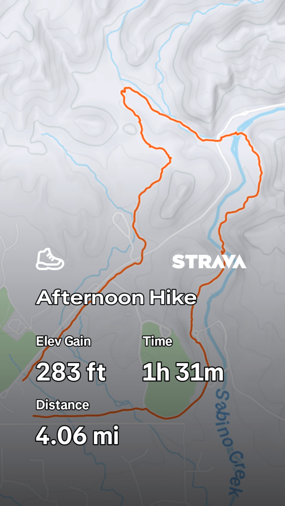
Sabino Canyon Recreation Center
Sabino Canyon is located in Northwest Tucson. Our family did the Sabino Lake, Creek Trail, Rattlesnake Trail, and Esperero Trail. With minimal elevation gain this was a leisurely walk with parts of the trail paved. For those with mobility challenges or traveling with a stroller, this hike was the most accessible one we did on our trip.
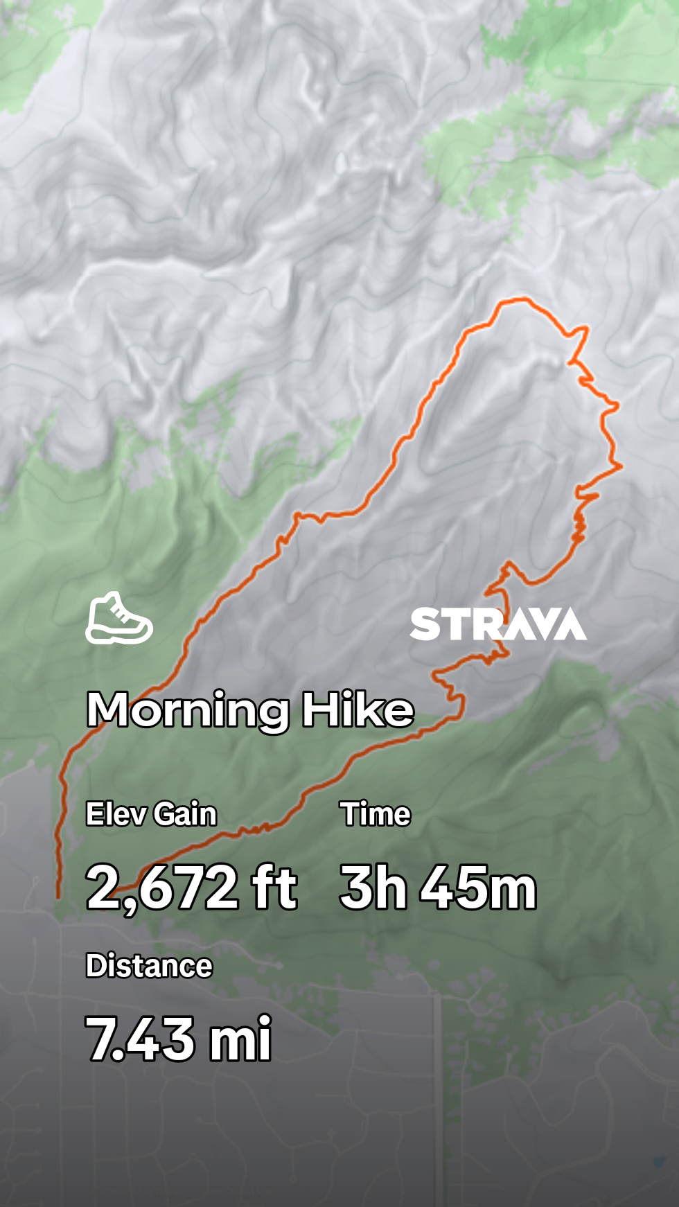
Bighorn Sheep Management Area
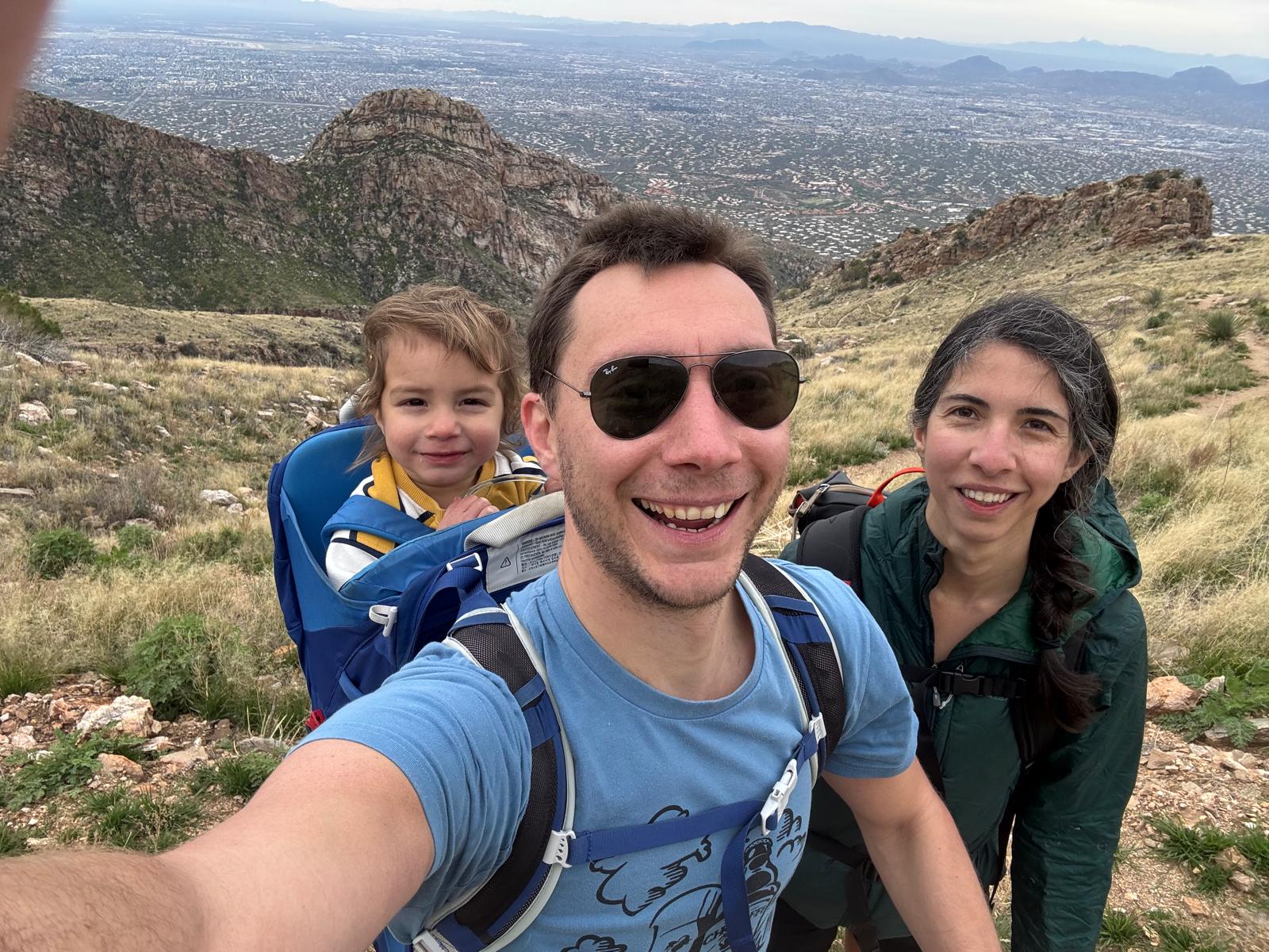
Located in Northwest Tucson and going through the Santa Catalina Mountains, this hike was the most strenuous during our visit to Southern Arizona. We hiked the Finger Rock, Pontatoc Connector, and Pontatoc Loop trail, taking us through rugged mountains and providing views of the city below. If the distance and elevation gain seem too ambitious for you or your crew, there are out and back options that are shorter and less of a climb.
https://www.alltrails.com/trail/us/arizona/finger-rock-to-connector-to-pontatoc-loop
Saguaro National Park
The park is split into two sections, Rincon Mountain District (RMD) to the East of Tucson, and Tucson Mountain District (TMD) to the west of the city. Both these hikes are in the East portion of the park.
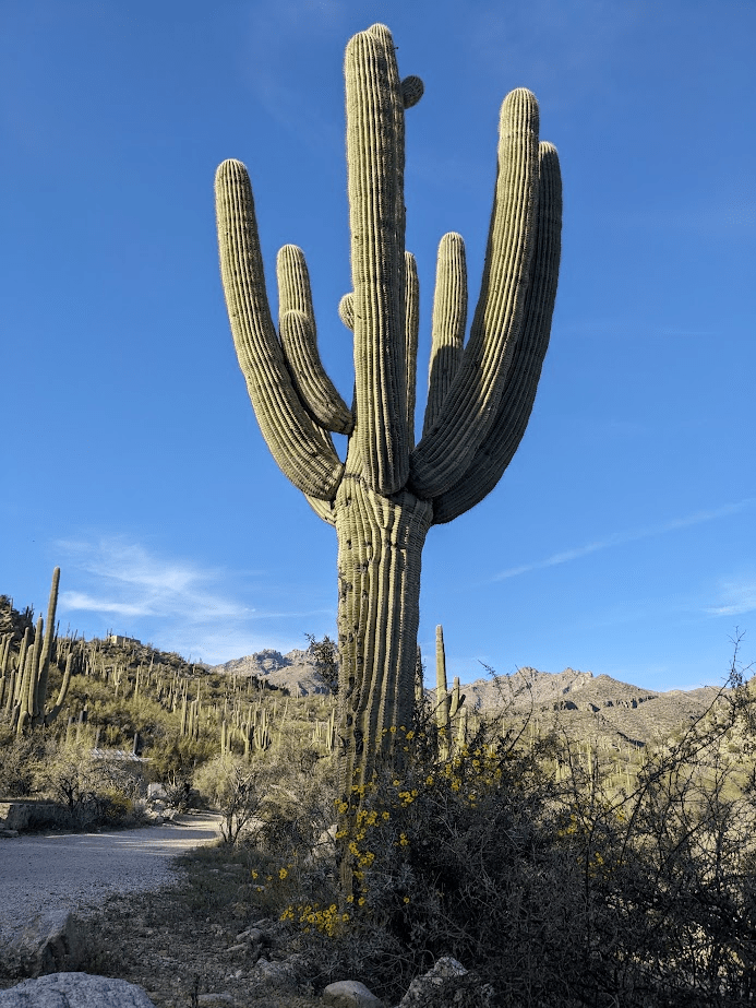
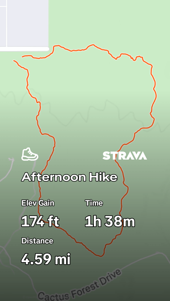
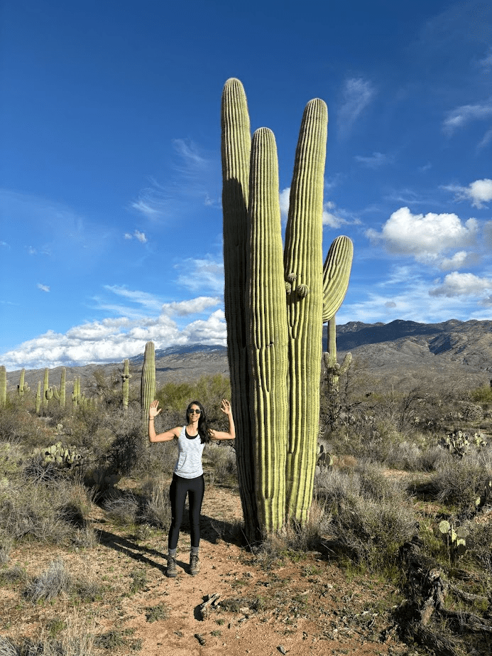
Pink Hill, Loma Verde, Cholla Trail, and Cactus Forest Loop
We used Pink Hill, Loma Verde, Cholla Trail, and Cactus Forest Loop trail as the base route for our hike. There are countless connecting trails, if you are comfortable navigating outside of a designated route, you can do add-on legs to create your own trail, which is what we did. While you will see saguaro cactus throughout the Tucson area, the ones on this hike were especially impressive in size.
https://www.alltrails.com/trail/us/arizona/pink-hill-loma-verde-cholla-trail-and-cactus-forest-loop
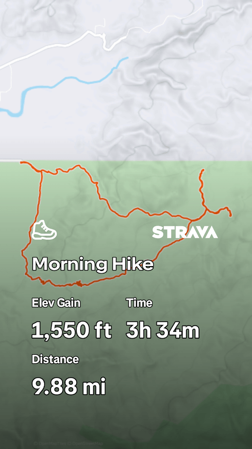
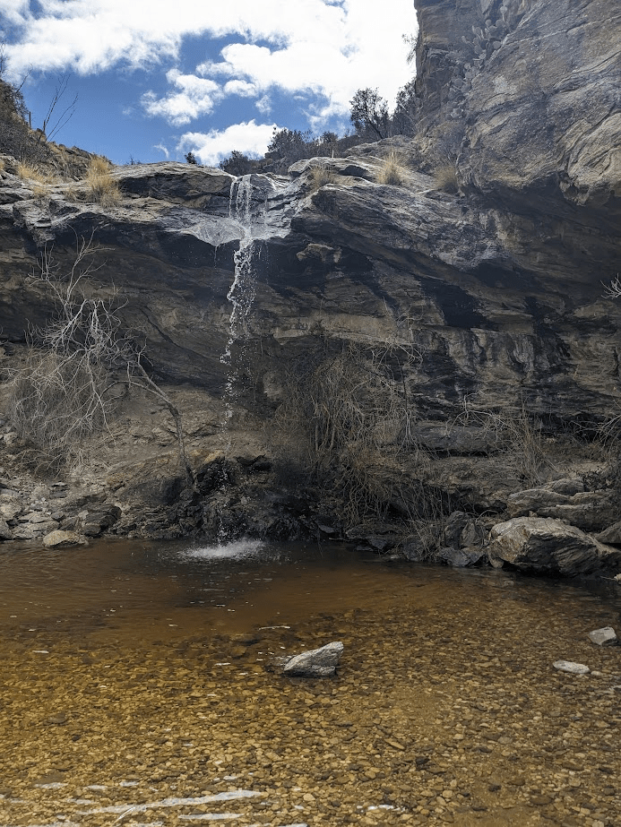
Douglas Spring, Bridal Wreath Falls, Three Tank, Garwood Loop
This popular waterfall hike deserves all the attention it gets. The strength, or existence of waterfall can vary by season, so check review trail reviews before heading out if you have your heart set on seeing the waterfall. This hike has much more elevation gain than the other hike we did in Saguaro, so if you want to visit the park and are looking for a more challenging route, this is a great contender.
Chiricahua National Monument
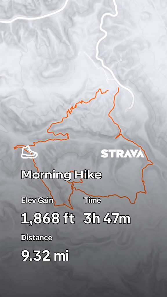
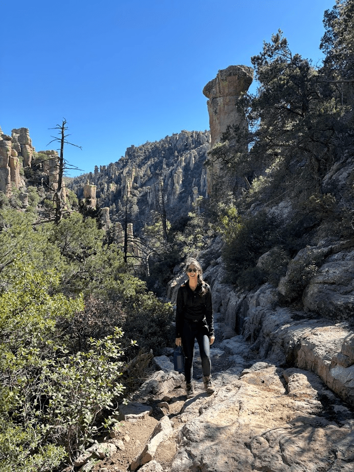
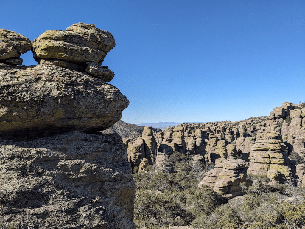
While part of the appeal of visiting Tucson is how many things are within an hour drive, Chiricahua deserves an exception. Our family was awe struck walking among the rock pillars formed by a volcanic explosion over 27 million years ago while hiking The Big Loop. Arrive early to snag a spot in the small parking lot. We nabbed the last spot as we pulled in at 9:30am. Shorter routes are accessible from the trail head if the Big Loop is too big for you or your companions. This hike ranges in elevation from about 5,900ft (1,800m) to 7,000ft (2,133m) above sea level so plan to bring layers, as temperatures will be cooler than the other hikes on this list.
https://www.alltrails.com/trail/us/arizona/the-big-loop–2

Leave a comment